We are all in this together: Collaboration among the motorized clubs of
Franklin County’s unorganized townships with the High Peaks Alliance
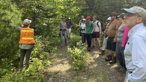
MADRID: There are hundreds of miles of snowmobile and ATV trails in the unorganized townships of northern and western Franklin County. There are less than a dozen small all-volunteer clubs throughout the region maintaining, managing, and marketing them.
Maintaining recreational trails involves continuing work. Bridges need to be built and rebuilt. Trails need to be rerouted and relocated. Environmental and safety issues need to be addressed. And, last but not least, the club’s maps need to be updated so the trails can be marketed to locals and visitors to the region.
“With their small and aging pool of leadership and labor and limited financial resources, keeping up with the growing demand for high-quality trails – trails that contribute to the nature-based tourism economy of the region – is no small challenge to the clubs,” says Betsy Squibb, a long-time member of the High Peaks Alliance.
In keeping with its mission, the Alliance, a local non-profit volunteer organization that has spent the last 13 years dedicated to keeping public access to the region, successfully submitted a request to the Franklin County Economic Development Council for a $64,000 TIF grant to support the trail maintenance projects of five clubs in the unorganized townships of the region.
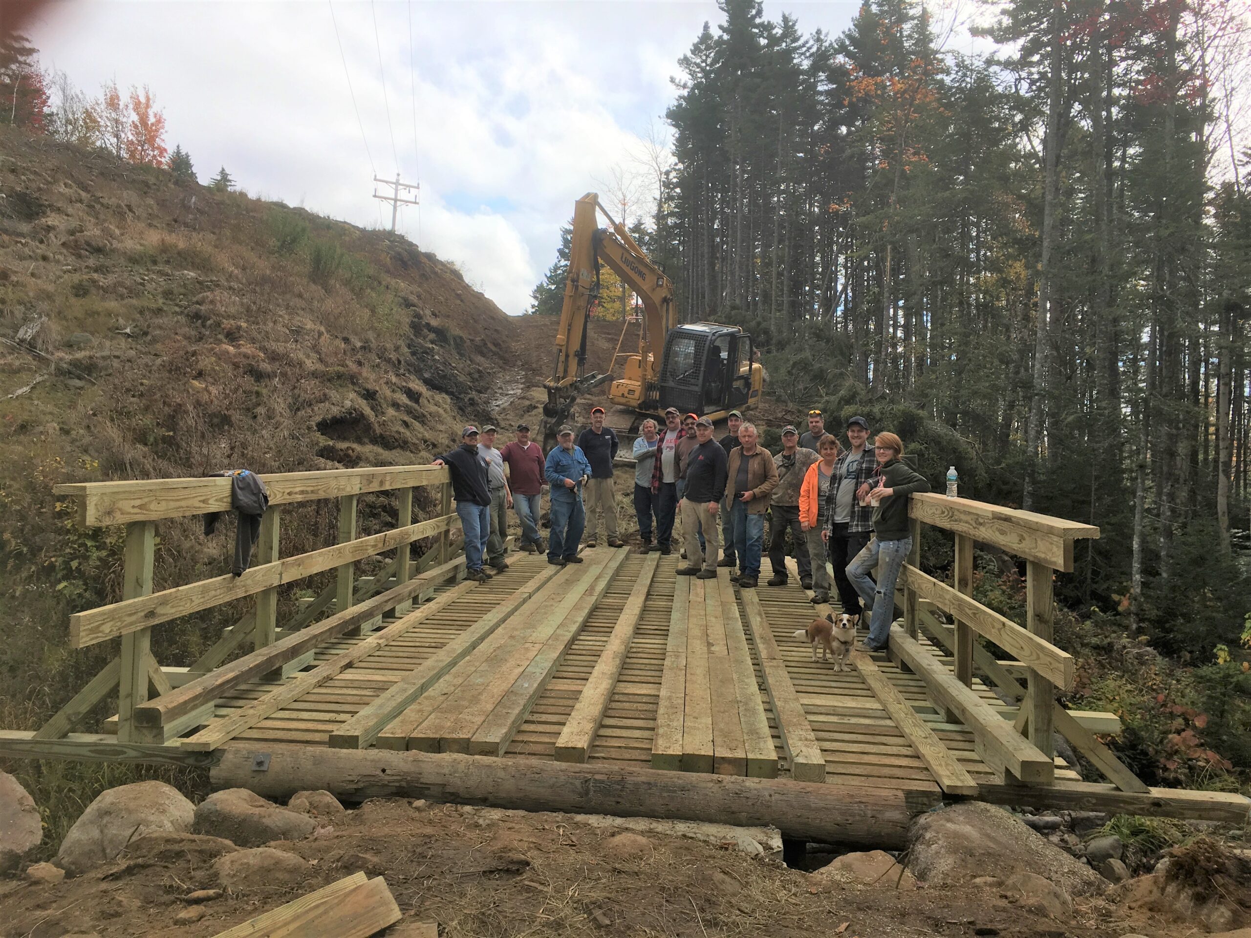
A recent final report noted that the Alliance had worked with the Roxbury’s Slippery Sliders Snowmobile and Roxbury ATV clubs, Phillips’ Northern Franklin Snowmobile Club, Strong’s Narrow Gauge Snowmobile Club, and Sandy River Riders. Three bridges were built, two bridges were rebuilt, two important State trails were rerouted, and several environmental and landowner issues were resolved. All projects included many hours of volunteer labor as well as cash contributions from the clubs.

In addition to supporting the club’s immediate trail maintenance needs, the Alliance also successfully submitted a $17,750 grant to the Council to address the long-term planning and marketing needs of motorized clubs. The project helped clubs collect GIS data from their trails. The Center for Community GIS in Farmington transformed the GIS data into a series of planning maps presenting a compilation of what currently is known about the region, including aerial photography, topography, town/township lines, landowner parcels, and more. The planning maps could then be used for trail relocation, and maintenance and as a basis for future club trail maps.
“The High Peaks Alliance projects have allowed us to work with other clubs to begin planning for uniform trail maps across multiple club’s trail systems. It would be awesome if the whole region had easy-to-read maps. Narrow Gauge Snowmobile Club started last winter by printing them poster size and mounting them at trail intersections,” said Dana Bowman of the Narrow Gauge Snowmobile Club in Strong.
The mapping project was a joint venture of the High Peaks Alliance, Maine Conservation Corps AmeriCorps, Maine Appalachian Trail Land Trust, the Wilderness Society, Maine Outdoor Heritage Trust, and the Jessie Cox Trust.
The High Peaks Alliance is a volunteer, non-profit organization made up of local hunters, hikers, birders, loggers, fishermen, snowmobile and ATV riders, Maine Guides, x-country skiers, mountain bikers, and others working together since 2007 to ensure continuing public access to Maine’s High Peaks Region for residents as well as visitors.
We welcome those who would set aside differences to work together to ensure public access for present and future generations in the High Peaks region.