June 21, 2024

Prescott Field Trail System
Visit Prescott Field Accessible Trail
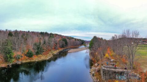
Built in partnership with High Peaks Alliance and the University of Maine at Farmington, this crushed-stone trail reroutes around steep areas. It leads visitors through a river floodplain and silver maple forest to the banks of the Sandy River.
The trail provides a peaceful, scenic experience with wildlife viewing, river access, and an easy route for visitors of many ages and abilities. Enjoy this unique place and help keep it open, cared for, and accessible for generations to come.
Plan Your Visit
- Trailhead & Parking: 283 Front Street, Farmington
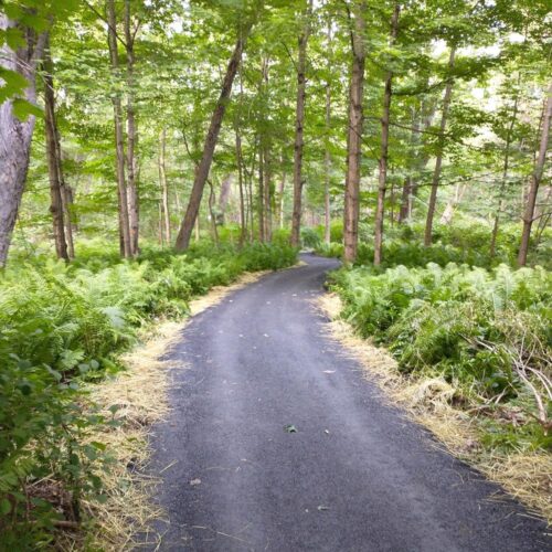
- Trail Length: .51-mile fully accessible trail; part of a larger 5-mile trail system
- Trail Description: Six-foot-wide crushed-stone accessible trail with a wide, stable surface near the Sandy River
- Difficulty: Easy
- Family Friendly: Yes
Renovations were funded through grants from the Maine Outdoor Heritage Fund, the Maine Timberland Trust, the Northern Forest Center, the Libra Foundation, and Franklin Savings Bank.
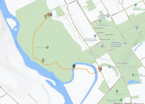
Discover the Accessible Trail in the 5-Mile Trail Network
The accessible trail connects and is part of a larger, 5-mile trail system throughout the fields and along the Sandy River.
For information and updates about the High Peaks Alliance and the region, subscribe to our newsletter.
Accessible Trail Timeline
2018
The project is initiated by Scott Hoisington, leading to the creation of a practicum project aimed at developing designated trails. The goal is to create a year-round trail system near the Sandy River plain. Initial trails are established in the forest area adjacent to athletic fields and in a rolling field behind UMF’s soccer field.
2019
The project expands with grant funding from the Maine Outdoor Heritage Fund.
Hoisington and Dr. Gina Oswald propose a grant to establish ADA-compliant kiosks and signage.
2020
Drs. Matt McCourt and Jessie Minor involve their First Year Seminar students in a mapping exercise focused on accessibility for users with vision and mobility impairments.
2021
Dr. Oswald’s students in the REH 222 course develop nature-based meditation recordings and mindfulness activities for the trails. Students in the REH 120 course volunteer to design ADA-compliant information signs.
The High Peaks Alliance secures additional funding from the Northern Forest Center to construct the first fully accessible trail in Franklin County within the Prescott Fields trail system.
The trail is designed to be six feet wide with a crushed rock surface, ensuring accessibility for individuals with mobility issues.
2022
The project continues to develop, with ongoing maintenance and the addition of more trails and features, including the long-term goal of providing ADA-compliant trails and a demonstration/information site for trail builders.
2023
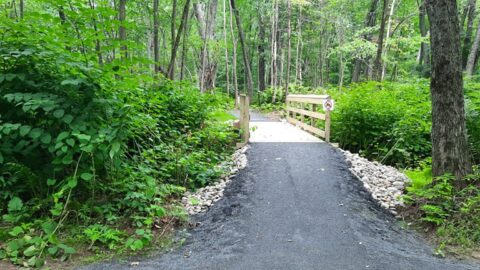
December storms cause severe flooding on the Prescott Field Accessible Trail. Flood waters destroyed an accessible bridge and left several inches of silt clay across the crushed stone path and parking lot.
2024
In June 2024, the High Peaks Alliance spearheaded the collaborative efforts to repair the Prescott Field Accessible Trail system after the region was impacted by severe flooding through the winter and spring.
E.L. Vining & Son donated riprap for the project. Dana Bowman of Boomtown Rustic Camp provided earthworks and replaced the bridge with a culvert. Ryan Wilford, of Red Door Title, generously donated his time and equipment to place the riprap and grade surfaces.
Additionally, students from the University of Maine’s Mainely Outdoors students removed the soil from the crushed stone surface to ensure the trail.
These students are the day-to-day stewards of this trail.